Geology
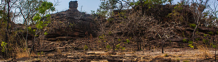
Most of the land in the Northern Region is designated geographically as ‘Voltaian Sandstone Basin’. It extends over an area of 112,768 sq. kms, representing close to 70% of Ghana’s surface area. The rock system comprises Palaeozoic sedimentary series formed around 300–500 million years ago. Rock component includes gentle dipping or flat–bedded sandstones, mudstones, shales, limestones, silt stones, etc.
These appear to be easily erodible. The landscape is one of flat extensive plain with a height range of 60–150 meters above sea level.
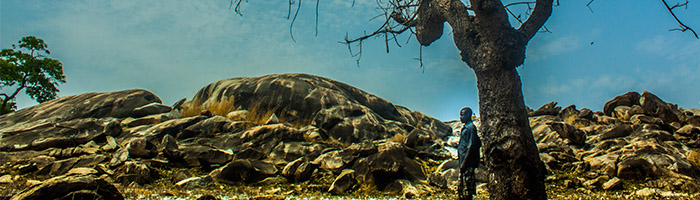
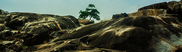
The lands located to the far west of West Gonja District, close to the Cote d’ Ivoire border, fall within the north–south physiographic zone geographically dubbed ‘Savannah High Plains’. The towns and villages located in this zone include Bole, Sawla, Tuna, Mankuma and Kuntasi. Geologically, the region is characterized by widespread Birrimian granite rocks, and the lands have a height range of 180-300 meters, a.s.l. There are high plains and gentle rolling land, interspersed with small rounded hills or inselbergs.
Soils:
Soil has been described as ‘a sort of living organism’. It is the surface part of the earth’s crust formed due to disintegration of rocks or minerals under the impact of local climate and drainage, as well as the action of plant and animal remains.
The Northern Region has a distribution of two major types of soil that critically influence agricultural and other subsistence activities. The first, and commonest, which covers nearly 70% of the savannah region, is the ‘Groundwater lateritic soil’. The second is known as the savannahOchro soil (The Greek ‘Ochro’ means highly coloured), and covers 30% of the savannah area.
Groundwater lateritic soil is yellowish brown or yellowish grey in colour. It is highly acidic, and poor in organic matter and nutrients. This kind of soil, therefore, poses problems to farmers in the northern savannahs.
The other major northern savannah soil type, the savannahochrosol is developed over sandstones, granites and Birrimian rocks. It is an acidic, well–drained, porous loamy soil. Because it is developed in savannah land with less rainfall than occurs in forestlands, it does not undergo leaching. This means that it does contain appreciable amount of nutrients and is generally alkaline (Dickson and Benneh 2001: 37–38).
It is well–attested that the relatively deep savannahochrosols of the Voltaian sandstone in Gonja and Dagomba have long been the leading areas in Ghana for the production of yam, guinea corn and millet.
|